The New FCC Maps

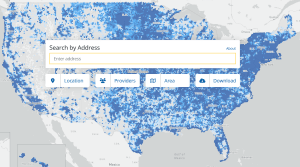
Mike Conlow was amazingly quick as usual and assembled a quick comparison of the new fourth version of the FCC broadband map to the previous third version. The new map reflects data as of December 2023.

The big change since the third version of the map is a big decrease in unserved and underserved locations. Mike’s count shows that total unserved and underserved locations on the map are now 8.8 million, down from 10.1 million. If true, this is a huge change in the rural broadband landscape.

There are a lot of factors that could impact a change of this magnitude. Before discussing these issues, here are the net changes between the third and fourth FCC broadband maps:

  • Total passings increased by 388,222.
  • Served passings increased by 1,644,756.
  • Underserved passings (25/3 Mbps to 100/10 Mbps) decreased by 157,132.
  • Unserved passings (under 25/3 Mbps) decreased by 1,099,402.

The change varies widely by state. For example, Nevada and North Dakota show over a 40%  drop in unserved locations, while nine states saw a drop of unserved locations under 5%. Arizona saw an increase of 8,925 unserved locations. The biggest drops in unserved locations were in Texas (-143,669), Missouri (-59,576), Michigan (-59,384), and California (-58,957).

The big question that must be asked is if these changes make any sense. Let’s start with a list of reasons why passings would change between the third to the fourth FCC maps.

Total passings should increase to reflect new homes being built. I’ve always wondered how CostQwest (the keeper of the FCC mapping fabric) is able to keep up with new home construction by address.

Total passings for a state can also increase or decrease due to corrections in the mapping fabric. In my own investigations, I’ve encountered a lot of homes that are not in the mapping fabric, locations in the fabric where there is no real-world building, and locations like barns that are not an addressable broadband location. I would hope that CostQuest is fixing these over time as they find better data sources. Changes can also come from individual challenges to the FCC maps for folks who complain their home isn’t listed in the fabric.

The biggest change to unserved and underserved passings probably comes directly from ISPs that have changed the way they are reporting in the FCC map. There are a number of reasons why an ISP might change its FCC reporting.

  • An ISP might have built new infrastructure and is properly reporting locations that now have a new source of broadband. New broadband construction might have been funded by state and local grants, RDOF, ReConnect, or other sources. Some ISPs are self-funding broadband expansion.
  • An ISP might have upgraded technology. A WISP might have upgraded radios and speeds. A cable company might have upgraded from DOCSIS 2.0 or 3.0
  • ISPs might have arbitrarily reported faster speeds. In looking at broadband mapping data in different places around the country, I’ve encountered a suspiciously large number of places where an ISP claims exactly 100/20 Mbps capability. That’s a speed that categorizes a location as served and makes it ineligible for BEAD grants and many other grants. I’ve seen the 100/20 Mbps speed claimed for DSL, fixed wireless, and cellular fixed wireless.

Recall that the FCC mapping rules only require ISPs to report marketing broadband speeds. If an ISP markets to customers with speeds ‘up to 100/20 Mbps’ it is not breaking FCC rules to make that claim in the maps – even if it only delivers 30/5 Mbps to a location. This FCC rule to allow marketing speeds instead of some approximation of actual speeds has made a travesty out of the maps.

Is it believable that 1.3 million fewer unserved locations in the country got upgraded to faster technology in a six-month period? Almost by definition, most of the unserved and underserved locations are rural. While there is a lot of fiber construction underway due to broadband grants, it’s hard to picture that grants covered that many new rural locations during a six-month period. Consider the amount of investment that would have required. If the average cost per upgrade was $6,000, this would have meant completing $7.8 billion of construction in the second half of last year in rural areas. It’s hard to think even half of that was spent in a six month period.

That is not a believable number. It seems a lot more likely that ISPs are changing the areas they claim to cover and the speeds they are claiming to provide.

Seeing these big mapping swings while States are trying to launch the BEAD grants is one more sign that BEAD will be a mess. Some states have already gone through the early stages of the BEAD map challenge, and these new changes will not have been reviewed or challenged by anybody. It seems more likely with every big mapping swing that more places will fall through the crack and that deserving locations will get skipped by BEAD.

Shouldn’t Broadband Mapping Data Belong to the Public?

I haven’t written a blog about FCC mapping for a while, and it feels almost wrong not to go on record about mapping in the new year. My biggest current pet peeve about the FCC mapping is that the agency made the decision to give power over the mapping and map challenge process to CostQuest, an outside commercial vendor.

The FCC originally awarded CostQuest $44.9 million to create the broadband maps. Everybody I know who works with mapping thinks this is an exorbitant amount, but if this was the end of the mapping story, then congratulations to CostQuest for landing a lucrative federal contract – lots of other companies have made hay doing so over the years.

Unfortunately, this is only the beginning of the mapping story because the FCC gave CostQuest the ability to own the rights to the mapping fabric, which is the database that shows the location of every home and business in the country that is a potential broadband customer. This is a big deal because it means that CostQuest, a private company, controls the portal for data needed by the public to understand who has or doesn’t have broadband.

A case in point is that soon after CostQuest created the first FCC map, the company was hired by the NTIA to provide the databases and maps for the BEAD grant process for a price tag of $49.9 million – more than the FCC paid to create the maps. CostQuest will also sell access to the mapping fabric to others for a fee. I have to imagine that the FCC is also paying CostQuest a big fee twice a year to update the FCC maps and to process map challenges.

I’m just flabbergasted that there is a private company that holds the reins to the database of broadband availability and which only makes it available for a fee.

I can’t think of even one reason why the database created by CostQuest is not openly available to everybody. The taxpayers funded the collection of this data and paid CostQuest handsomely to organize it. For various reasons, the public can’t easily use the data. The FCC makes a snapshot of the data available to the public in the FCC broadband map and allows everybody to look at their home or any other home or neighborhood in the country. While that is useful information, the average person can’t do much more than that, and it is impossible to use the FCC map to fully understand broadband across a city, a county, or a region. To understand broadband in a city would require looking manually at each household and somehow digesting what it all means.

The fault for this lies squarely with the FCC. I can’t imagine how folks at the FCC could think it is reasonable to pay a vendor to create a database and then relinquish ownership of the database to the company that created it. I wouldn’t be bothered if the FCC created a long-term contract with CostQuest to update the database, although periodic competition for ongoing work would make sure the public gets a good deal.

Our industry is full of data geeks who could work wonders if they had free access to the mapping fabric database. There are citizen broadband committees and retired folks in every community who are willing to sift through the mapping data to understand broadband trends and to identify locations where ISPs have exaggerated coverage claims. But citizens willing to do this research are not going to pay the fees to get access to the data – and shouldn’t have to.

The FCC says that getting broadband to everybody is its most important mission. However, restricting access to mapping data doesn’t support that sentiment. It almost feels more like the FCC doesn’t want folks pointing out the many errors in the data, which is a shame. Nobody expected mapping data that is reported by ISPs to be accurate since ISPs all have their own agendas. When the new maps were created. I had high hopes that an army of volunteers could challenge the ISPs and set the record straight. It seems like the FCC went out of its way to make sure that doesn’t happen by giving a gatekeeper the ownership of the data.

Access to the FCC Broadband Maps

I suspect that there are already a lot of communities and other folks who are in violation of the license agreement to view and use the new FCC mapping fabric and associated data. CostQuest, the firm that created the mapping fabric, has provided communities and others with a basic license to view and utilize the mapping data strictly for the purpose of the Broadband Data Collection (BDC) process – for reviewing and challenging the FCC maps.

Anybody that wants to use the mapping data for any other purpose must sign a different agreement and pay to utilize the data. The basic CostQuest agreement clarifies that the mapping data can’t be used for any other purposes and gives examples of uses that are prohibited under the basic use contract. Communities or others with the basic license can’t use the mapping data to:

  • Prepare for the BEAD program, grant proposals, or other funding initiatives.
  • Broadband Mapping.
  • Opportunity Analysis.
  • Network Planning or Design.
  • Marketing purposes, such as sending mailers to addresses or identifying new customers to target marketing efforts.

I have to think that communities have already violated some of these prohibitions. It’s natural when getting the new data to want to map it so that elected officials and other stakeholders can see what has been reported to the FCC. I have a hard time thinking that ISPs won’t use the data when determining areas that are eligible for grants.

I am completely flabbergasted by this whole process. The FCC paid CostQuest $44 million to create the maps. One would think that would mean the resulting maps and data belongs to the FCC, and that CostQuest is just a vendor hired to create the maps and mapping fabric. But it appears that having created the maps is creating a permanent revenue stream for CostQuest, and the company is acting as if it is the owner of the federal mapping data. The NTIA has been negotiating to pay an additional $49.9 million to CostQuest to be able to use the mapping data during the BEAD grant process.

You have to let that sink in. One federal agency is paying a license fee that is higher than the cost of creating the maps in order to use the data that is gathered by the FCC. I have to imagine that CostQuest plans to extract fees from ISPs and communities to use the data for any purpose other than the BDC mapping challenge.

This raises a lot of questions, starting with the big question of why the FCC would allow a vendor to extract big fees to utilize a software system and data mandated and paid for by the FCC. Perhaps the bigger question is why broadband mapping data isn’t publicly available to everybody.

The funny thing is that you don’t need a license to use the data – just a license to use it easily. I looked at my own neighborhood, and I can see the ISPs that claim to be able serve each home, and in doing so I can see the border of any ISP’s claimed service area. For example, I can see in my neighborhood the several block area where AT&T has built fiber.

A small town could easily gather and map everything about its community by gathering the data for each home from the national map provided by the FCC. The licensing makes things easier by allowing the use of the underlying databases needed to analyze the data in mass instead of one home at a time.

It’s easy to see why there was such a big battle to win the mapping RFP, because this created a huge new permanent revenue stream for CostQuest to provide access to use the FCC data. I wrote a blog earlier this year talking about creating policies to make sure that communities have access to government data. I don’t know if there is anything more vital to communities with poor broadband than understanding the broadband map of who has and doesn’t have access to broadband.

I hope that the FCC will come to its senses and reclaim its own data, or at least mandate that it should be easily available to everybody. If not, this is something Congress ought to address. We’re spending billions to bring better broadband while absurdly making it hard for communities to use the public data that documents broadband coverage.

Maybe some smart programmer will solve this for everybody by capturing the data one house at a time from the FCC map and make the data available to everybody for free.

How Good are the New FCC Maps?

The long-promised new FCC maps came out recently, and everybody rushed to see what the maps said about their own home. But a lot of folks looked deeper to try to understand the difference between this and earlier maps. There are two ways to judge the maps – the mapping fabric and the broadband coverage story.

The mapping fabric represents the FCC’s attempt to count the number of locations with or without broadband. They chose to do this by trying to put every potential broadband customer on the FCC map. The FCC hired CostQuest to create the mapping fabric, and the company used a variety of data sources to pinpoint locations on the fabric.

The State of Vermont has already sent a challenge letter to the FCC that says that 11% of the locations in the FCC mapping Fabric don’t match Vermont’s own data. Even worse, Vermont says that 22% of locations it knows about are missing from the FCC map.

I looked at my own neighborhood, which is deep inside Asheville, NC. My neighborhood was established one hundred years ago, and as I expected, most homes are shown on the FCC map. But the FCC maps did not show several new homes that were built here in the last few years. My guess is that the FCC maps generally do better in cities than in suburbs and total areas.

Vermont also looked at the broadband coverage claims by ISPs. According to the new maps, over 95% of Vermont homes have access broadband to broadband of at least 100/20 Mbps. The State created its own broadband maps, which show that only 71% of homes in the state could receive broadband at 100 Mbps or faster at the end of 2021. In looking at the data, the difference seems to come from claims on the new FCC maps that satellite and fixed wireless broadband can reach huge numbers of folks – something that is not true in hilly and wooded Vermont. There also are ISPs that have claimed speeds that are faster than what the State believes is being delivered.

Industry folks have said all along that the new maps are not going to be any better than the old ones if an ISP can claim any marketing speed it wants with no repercussions for exaggerating speeds. There seems to be a lot of work still needed if the new maps are going to be used to allocate BEAD funding to states and, more importantly, to define areas that are eligible for grant funding.

On a local level, the new reporting is interesting. For example, in looking around my city, I can now find the little pockets where AT&T has built a few blocks of fiber. There was no way in the past to be this granular. The new maps are going to drive a lot of folks crazy to see that fiber is only a block away.

The new maps also let me look at Charter’s coverage in more detail than ever before. It’s been said for years that the big cable companies don’t serve everybody in cities, and assuming that Charter is reporting coverage accurately, this can now be verified. I found little pockets all around my city where Charter doesn’t serve. The old FCC reporting by Census block normally showed everybody in a metropolitan area having access to cable company broadband. The new map also shows at the edges of the city how Charter hops over some neighborhoods to serve others that are farther out.

My own house shows a lot of ISP options, some of which don’t really exist. For example, there are several WISPs shown as covering my neighborhood. There is no way that is possible from where the towers are located due to the large hills in the city that creates huge wireless dead zones. The cellular broadband speeds reported were a little more accurate. Verizon doesn’t show coverage at my home at all – which is true since there are also zero bars of voice coverage at my end of the block. I’m not sure why T-Mobile even bothers reporting the 0.2 Mbps speeds – that might be true – but isn’t that really zero broadband? The satellite speeds reported at my house are improbable in a city surrounded by a bowl of mountains and a lot of trees.

For those who haven’t looked yet, here is the new map. I’d be interested to hear from anybody who was surprised by what the maps show for your home.

Restricting FCC Mapping Data

Last week, the FCC rejected dozens of requests from ISPs to keep confidential the method that the ISPs use to identify broadband coverage areas. This was prompted by the FCC requiring each ISP to explain to the agency how it determined broadband coverage areas in the latest round of gathering data for the FCC broadband maps.

Several dozen ISPs then asked the FCC to keep those responses confidential, with most ISPs arguing that the method of how customers are counted reveals proprietary data about the ISP networks. The FCC rejected all such arguments and commented that the public needs to know how customers and coverage areas are determined if there is to be any meaningful review and challenge of the FCC mapping data.

By the way, we now have some new industry acronyms. The FCC is referring to the new mapping process as the BDC (Broadband Data Collection initiative). A second new acronym is mapping fabric, meaning the underlying data that supposedly shows the location of every building in the country where somebody could order broadband. It’s always been hard to know if it’s deliberate but referring to regulatory efforts using new acronyms acts to confuse the public about what is going on. Somebody reading a news article talking about the BDC and challenges to the fabric likely has no idea what is being discussed.

All of this matters because the FCC has already started the process of allowing challenges to the mapping fabric. Local governments and ISPs are now able to challenge the locations of the ‘passings’, which are residential and business locations that could be a customer for broadband. There have been early comments made that there are a lot of errors in the fabric developed by CostQuest. There are some places where too many passings have been identified, such as a farm where there are multiple buildings, most of which are not candidates to buy a broadband subscription. I’ve also heard there are places where a lot of actual passings are missing from the map. Most confusing is that there are a lot of places in the country that nobody knows how to count – such as vacation cabins.

One of the biggest hurdles to the fabric challenge is that the FCC mapping fabric data is not widely available for the public to examine. CostQuest has provided free access to localities to review local data, although some local governments are saying that it has been a challenge to get access to the data. Unfortunately, the contract between CostQuest and local government restricts the use of the data only for purposes of challenging the fabric data. It seems a local government can’t disclose details about the fabric to its citizens.

The FCC mapping data is not being made available to the general public. This makes challenging the maps difficult for rural counties, which mostly don’t have the resources to take the time to understand, let alone challenge the maps. Keeping the data proprietary means that the general public can’t participate in this challenge. In many rural counties, there are ad hoc broadband committees that would devote the time and energy to understand the local maps. But local folks who are interested in broadband but who are not officially sanctioned by the local government are not being allowed access to the data. The data is also not available generically to nonprofits, consultants, or others that have the technical skills to analyze the data.

I guess this means that the mapping fabric challenge is supposed to be done by local governments that don’t have the staff, funding, time, or technical expertise to understand the mapping fabric, let alone suggest corrections. Most of the rural counties I know are not reviewing the fabric – meaning that nobody is reviewing the broadband data in the places that most need better broadband.

I know several folks who are trying to find out how this happened – how a commercial business like CostQuest is allowed to act as if it owns the mapping data. Apparently, the FCC contract with CostQuest has given the company the right to monetize the data. I hope after the facts are better known that Congress will step in and makes all FCC mapping data open to the public.

I wrote recently about the data divide – where public data is not making it to the folks that need it the most. The federal government is spending huge amounts of money developing maps that show areas with and without access to broadband. I can’t think of a single reason why this data isn’t available to everybody. But I can think of two reasons to keep the data restricted. First, this will tamp down on a raft of news articles talking about errors in the mapping fabric. The second reason is to give CostQuest the chance to monetize the process. In my opinion, these are both unacceptable ways to treat data that was created with taxpayer money.

The FCC Mapping Fabric

You’re going to hear a lot in the next few months about the FCC’s mapping fabric. Today’s blog is going to describe what that is and describe the challenges of getting a good mapping fabric.

The FCC hired CostQuest to create the new system for reporting broadband usage. The FCC took a lot of criticism about the old mapping system that assumed that an entire Census block was able to buy the fastest broadband speed available anywhere in the Census block. This means that even if only one home is connected to a cable company, the current FCC map shows that everybody in the Census block can buy broadband from the cable company.

To fix this issue, the FCC decided that the new broadband reporting system would eliminate this problem by having an ISP draw polygons around areas where it already serves or could provide service within ten days after a customer request. If done correctly, the new method will precisely define the edge of cable and fiber networks.

The creation of the polygons creates a new challenge for the FCC – how to count the passings inside of any polygon an ISP draws. A passing is any home or business that is a potential broadband customer. CostQuest tried to solve this problem by creating a mapping fabric. A simplistic explanation is that they placed a dot on the map for every known residential and business passing. CostQuest has written software that allows them to count the dots of the mapping fabric inside of any possible polygon.

That sounds straightforward, but the big challenge was creating the dots with the actual passings. My consulting firm has been helping communities try to count passings for years as part of developing a broadband business plan, and it is never easy. Communities differ in the raw data available to identify passings. Many counties have GIS mapping data that shows the location of every building in a community. But the accuracy and details in the GIS mapping data differ drastically by county. We have often tried to validate GIS data to other sources of data like utility records. We’ve also validated against 911 databases that show each registered address. Even for communities that have these detailed records, it can be a challenge to identify passings. We’ve heard that CostQuest used aerial maps to count rooftops as part of creating the FCC mapping fabric.

Why is creating a fabric so hard? Consider residential passings. The challenge becomes apparent as soon as you start thinking about the complexities of the different living arrangements in the world. Even if you have great GIS data and aerial rooftop data, it’s hard to account for some of the details that matter.

  • How do you account for abandoned homes? Permanently abandoned homes are not a candidate for broadband. How do you make the distinction between truly abandoned homes and homes where owners are looking for a tenant?
  • How do you account for extra buildings on a lot. I know somebody who has four buildings on a large lot that has only a single 911 address. The lot has a primary residence and a second residence built for a family member. There is a large garage and a large workshop building – both of which would look like homes from an aerial perspective. This lot has two potential broadband customers, and it’s likely that somebody using GIS data, 911 data, or aerial rooftops won’t get this one property right. Multiply that by a million other complicated properties, and you start to understand the challenge.
  • Farms are even harder to count. It wouldn’t be untypical for a farm to have a dozen or more buildings. I was told recently by somebody in a state broadband office that it looks like the CostQuest mapping fabric is counting every building on farms – at least in the sample that was examined. If this is true, then states with a lot of farms are going to get a higher percentage of the BEAD grants than states that don’t have a lot of compound properties with lots of buildings.
  • What’s the right way to account for vacation homes, cabins, hunting lodges, etc.? It’s really hard with any of the normal data sources to know which ones are occupied full time, which are occupied only a few times per year, which have electricity, and which haven’t been used in many years. In some counties, these kinds of buildings are a giant percentage of buildings.
  • Apartment buildings are really tough. I know from working with local governments that they often don’t have a good inventory of the number of apartment units in each building. How is the FCC mapping data going to get this right?
  • I have no idea how any mapping fabric can account for homes that include an extra living space like an in-law or basement apartment. Such homes might easily represent two passings unless the two tenants decide to share one broadband connection.
  • And then there is the unusual stuff. I remember being in Marin County, California and seeing that almost every moored boat has a full-time occupant who wants a standalone broadband connection. The real world is full of unique ways that people live.

Counting businesses is even harder, and I’m not going to make the list of the complexities of defining business passings – but I think you can imagine it’s not easy.

I’m hearing from folks who are digging into the FCC mapping fabric that there are a lot of problems. ISPs say they can’t locate existing customers. They tell me there are a lot of mystery passings shown that they don’t think exist.

We can’t blame CostQuest if they didn’t get this right the first time – Americans are hard to count. I’m not sure this is ever going to be done right. I’m sitting here scratching my head and wondering why the FCC took this approach. I think a call to the U.S. Census would have gotten that advice that this is an impossible goal. The Census spends a fortune every ten years trying to identify where people live. The FCC has given itself the task of creating a 100% census of residences and businesses and updating it every six months.

The first set of broadband map challenges will be about the fabric, and I’m not sure the FCC is ready for the deluge of complaints they are likely to get from every corner of the country. I also have no idea how the FCC will determine if a suggestion to change the fabric is correct because I also don’t think communities can count passings perfectly.

This is not the only challenge. There are going to be challenges of the coverage areas claimed by ISPs. The big challenge, if the FCC allows it, will be about the claimed broadband speeds. If the FCC doesn’t allow that they are going to get buried in complaints. I think the NTIA was right to let the dust settle on challenges before using the new maps.